
“A time to break down, and a time to build up….”
Ecclesiastes 3:3

ABOVE: The old Warrenville Mill in May 2015. There was talk, then, about decontaminating the property and opening a children’s museum, or using the building to train Aiken Tech students, or to restoring it for apartments. Photo by Laura Lance

ABOVE: The old Warrenville Mill in May 2024, in the process of being restored and repurposed for a luxury apartment community. Photo courtesy of Michael Aiken
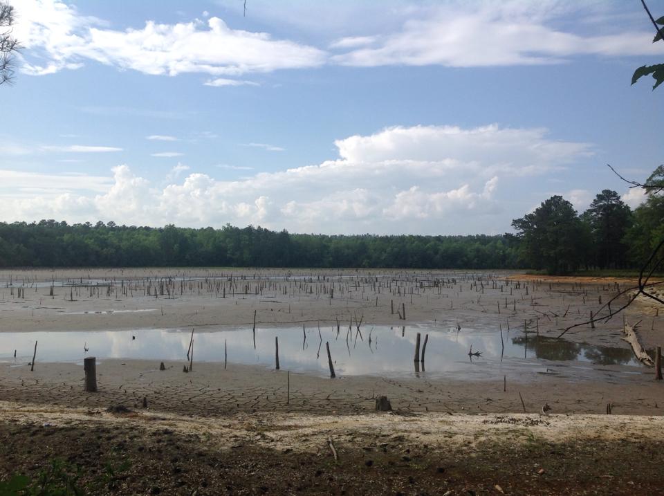
ABOVE: Langley Pond in May 2015, drained down after the dam leak and closed indefinitely. Back then, the two big unknowns were, “How to fix the leaking dam?” and “How to pay for it?” There was no guarantee it would ever reopen. Photo by Laura Lance
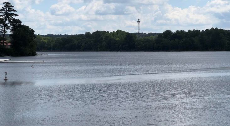
BELOW: Photos of Langley Pond in 2024, transformed back into an even better park. Photos courtesy of Greg Bramlett


BELOW: The old Langley Train Station transformed into a library.(Photos courtesy of Wren Dexter)


BELOW: Scenes from Langley-Bath-Clearwater, an old and historic landscape rich with springs and creeks and pines, hickories, oaks, sassafras and sycamores with a environmentally diverse understory of woodland plants and wildlife — all of this juxtaposed with the relics of industry, at turns artful, ghastly, curious and beautiful — an area ripe for discovery and restoration. (Photos courtesy of Greg Bramlett)


BELOW: The historic Jefferson Elementary School which currently has a student enrollment of about 539 students. The school is located in Bath, SC near the proposed Rabbit Hill Class 2 Landfill. Photos by Michael Aiken.


BELOW: Forested lands on clay company property off of Dixie Clay Road in Bath. (Photos courtesy of Lisa Smith)


“Growing up on this land threatened by the imposing landfill, I developed a deep connection to it. Wild things grow in areas that have remained natural since the 70’s and well beyond my years, while prairie style grasses thrive in open areas and old growth pines provide a home for the red cockaded woodpecker. Deer and turkeys now find refuge in this green oasis, where Canadian geese have also made their home. From the tallest peak, one can see all of the CSRA, and pitching a tent and watching fireflies light up the night sky was a favorite pastime….”


ABOVE: Shades of twilight viewed from a rise in Bath, the North Augusta skyline visible in the distance.(Photos courtesy of Greg Bramlett)
“We played ‘avalanche,’ jumping from the ridge and sliding down the soft, red clay. Living there taught me to appreciate the peace and tranquility that nature provides, and it remains just as serene today, even more so now as a sanctuary. The whippoorwill, owl, rain crows, and frogs by the millions after the rain create an orchestra of sounds….”

ABOVE: Woodland acreage along the property line between a family of long-time Bath residents and the proposed new landfill.
BELOW: Dedication monument and creek-side view at Harrison Caver Park, once the site of the Clearwater Swamp dump, now the site of a busy community center and park, which is also the terminus of the 9-mile Horse Creek Water Trail for canoes and paddler that runs from Graniteville to Langley and Clearwater. (Photos courtesy of Greg Bramlett)


“It takes years for nature to evolve its home, but only days for the greed of man to destroy it. I fear that few people care about the impact of their actions on this land, which has been scarred by mining but has slowly recovered. This land would have been better suited as a living history park, one that recognizes the history of everyone and everything that made this area special.” — Bath resident, Greg Bramlett